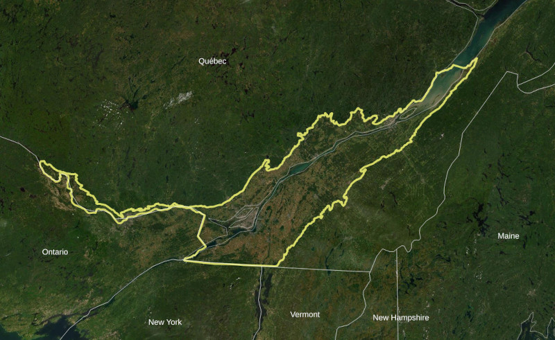
Study area used in the "atlas des territoires d'intérêt pour la conservation dans les basses-terres du Saint-Laurent" (approximately 32,350 sq kilometers)
Over the last decade, we have worked closely with the Ministère de l'Environnement et de la Lutte contre les Changements Climatiues (MELCC) of the Quebec government to identify habitat priorities for the protection and restoration of habitat connectivity. We have focused our efforts on the ecoregion of the Saint Lawrence Lowlands within Quebec. Connectivity conservation emphasizes the importance of keeping habitats connected so that species can move freely and persist in human dominated landscapes. Increasing connectivity means restoring terrestrial and aquatic habitats (e.g. forests and wetlands) by either adding wildlife corridors or removing barriers to movement to mitigate the effects of human land-use change and the infrastructure (e.g. roads) that impede their movements and increase their mortality. Some parts of the region are particularly important for connectivity, so our work identifies priority areas for conservation action. An important feature of our work is an effort to understand what the future climate and land use will look like over the coming century so that we can make decisions today that ensure habitat connectivity in the future. We work with many stakeholders in the region to communicate our findings and ensure that our results are available to all.
Financed by: Direction générale de la conservation de la biodiversité, Ministère de l'Environnement et de la Lutte contre les changements climatiques
Contributors: Bronwyn Rayfield, Guillaume Larocque, Kyle Martins, Valentin Lucet, Fanny Maure, Colin Daniel, Yan Boulanger, Andrew Gonzalez
Conservation prioritization of natural habitats in the St. Lawrence Lowlands based on their importance for ecological connectivity
Summary
To ensure the sustainability of biodiversity and ecosystem services in fragmented landscapes, current conservation plans increasingly focus on protecting connected habitat networks. Habitat connectivity assessments quantify the extent to which a habitat network is connected, based on the spatial arrangement of habitat patches and dispersal corridors, in relation to the dispersal capacities of the species that use these networks. In the St. Lawrence Lowlands, natural areas have largely been converted to agricultural and urban areas resulting in many small patches that now make up just 30% of the Lowlands. We identified conservation priorities among the remaining natural areas in the Lowlands based on the habitat quality and connectivity of a set of focal species: northern short-tailed shrew, American marten, red-backed salamander, wood frog, and black bear. We have identified five main conclusions:
- Terrestrial natural areas represent 30% of the Lowlands spread over patches of different sizes. Both small and large patches are important for the quality of habitat and ecological connectivity of the region.
- Among these patches, some large patches located between Trois-Rivières and Quebec City were identified as high priorities. Smaller patches, in the Montérégie and around LakeSaint-Pierre, are also of high priority.
- High priority conservation corridors were identified along the south shore of Lake Saint-Pierre, from Lake Saint-Pierre to Mont Saint-Hilaire (southeast), and from Lake Saint-Pierre to the forested areas between Trois-Rivières and Quebec City (northwest).
- Species' sensitivity to habitat loss varies, but all species will see their habitat quality and connectivity decrease in the scenario of continued loss of natural areas.
- The value of the high priority patches and linkages identified in these analyses is not independent of the surrounding landscape and any degradation of the surrounding landscape may decrease the value of these high priority areas.
The conservation priority maps presented in this report are intended to guide integrated landscape management decisions whereby the interconnectedness of habitat fragments and the surrounding landscape is factored into decision-making. Our results demonstrate the merit of a joint analysis of the quality and connectivity of natural areas.
Changing terrestrial habitat connectivity within the St. Lawrence Lowlands under scenarios of climate and landcover change
Summary
We have developed an integrated model combining land use and forest-change simulations, regional climate projections, habitat connectivity analyses, and conservation prioritization. We applied the model to forecast ecological connectivity over the coming century under a range of land use and climate scenarios in the St. Lawrence Lowlands natural province in Quebec (30 000 sq km). Our results shed light on the potential consequences of future land use and climate change for forest and wetland-dependent biodiversity in this landscape based on habitat and connectivity analyses for five representative focal species: the Northern short-tailed shrew, American marten, Red-backed salamander, Wood frog, and Black bear. Our analyses have led to five main conclusions:
1. The main driver of habitat loss and fragmentation in our model was urbanization with projected losses of 16% of forests and 8% of wetlands between 2010 and 2110 based on a business-as-usual land use scenario. Small fragments of forest close to existing urban areas were most vulnerable to being lost.
2. Ecological connectivity is expected to decline overall in the St. Lawrence Lowlands over the course of the next century under the business-as-usual land use and RCP 8.5 climate scenario. The extent of connectivity losses varies across focal species and across the Lowlands ranging from 1% to 12%. Connectivity losses are associated with the decline and fragmentation of suitable habitats, resulting primarily from urban expansion and climate change.
3. Four of the five forest and wetland dependent focal species in our 100-year simulation were more negatively impacted by land use change than climate change. Long-term conservation of these species and the biodiversity that they represent will require a reduction in land-conversion rates and a focus on habitat restoration to compensate for ongoing habitat loss.
4. One of the five species, the American marten, had higher habitat loss and fragmentation due to climate change than due to land use change over the simulated period. This species’ response characterizes the response of other species with habitat niches that
are threatened by climate change.
5. Accounting for future scenarios of land use and climate change in conservation prioritization strongly modified priority areas. Higher priority was assigned to natural areas at high risk of being lost due to land use or climate change such as those close to existing urban centers. Priority was also given to areas where habitat suitability and connectivity importance are expected to increase under land use and climate change such as the forest and wetland corridor between Trois-Rivières and Quebec City.
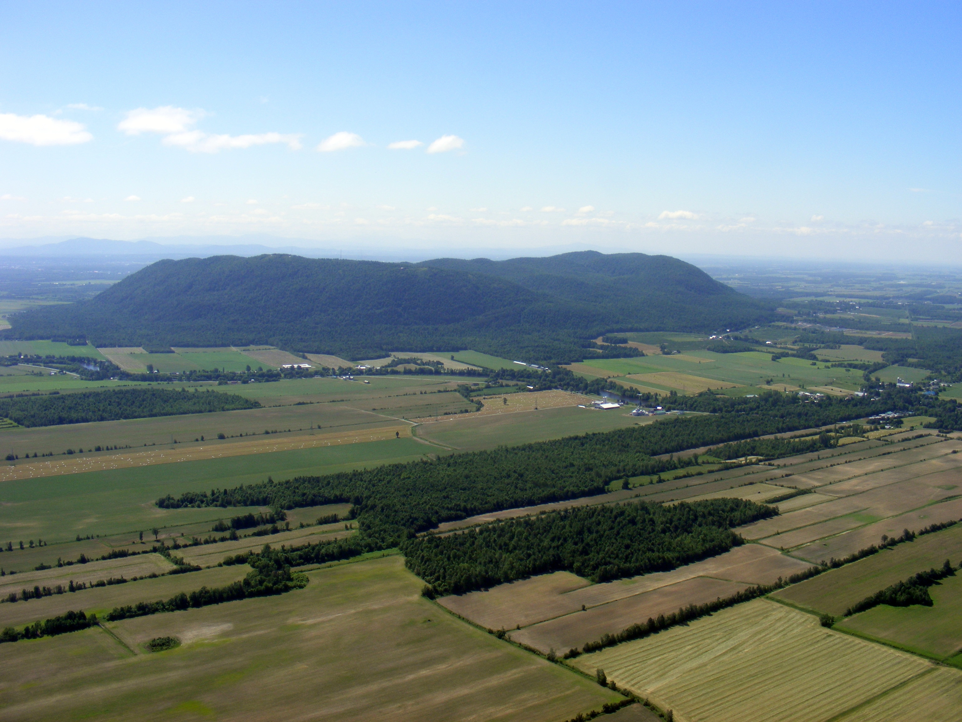
 Mont Yamaska 2007, Photo: Tingxian Li (Ministère de l'Environnement et de la Lutte contre les changements climatiques)

